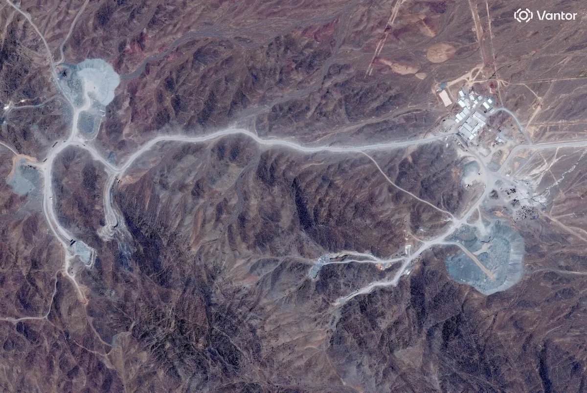
Mount Kalang Ghazla: A New Front in the Iran Nuclear Dispute
Recent reports have revealed that Israel has informed the administration of former President Donald Trump about possessing intelligence indicating that Iran transferred thousands of uranium enrichment centrifuges to a fortified complex situated within Mount Kalang Ghazla last fall. This revelation has thrust the site into the spotlight of political and military interest, particularly as it had long remained an obscure project with little known about its nature. The names of the facilities "Natanz" and "Fordow" are no longer the only ones dominating the escalating confrontation between the United States and Iran. Instead, in recent weeks, Mount Kalang Ghazla, also referred to as "Jabal al-Fas," has emerged prominently. Located south of the Natanz nuclear facility in Isfahan province, the mountain has become a focal point of military threats exchanged between Washington and Tehran, especially with growing questions regarding its potential role in the future of Iran’s nuclear program.
This shift in attention followed disclosures from the Wall Street Journal, sourced from American and Israeli officials, asserting that Israel had provided the Trump administration with intelligence confirming that Iran had relocated centrifuges to the heavily fortified site within the mountain. This information has elevated the site to the forefront of political and military discourse, turning it from a vague project into one that is now under intense scrutiny.
The Evolution of Mount Kalang Ghazla
The significance of Mount Kalang Ghazla lies not only in the nature of the facilities that may be located within it but also in its design. Following the attack on the Natanz facility in 2020, which resulted in considerable damage, Iran’s leadership decided to relocate a portion of its nuclear infrastructure into the mountains. The goal was not merely to create alternative facilities but to construct sites capable of withstanding the most advanced aerial strikes, ensuring that the nuclear program could continue even if traditional facilities were destroyed. Situated approximately 1.5 kilometers south of the Natanz facility, Mount Kalang Ghazla rises about 1608 meters above sea level and is characterized by its geological composition, with estimates indicating that the complex is built at a depth of 90 to 137 meters within solid granite, a depth that surpasses that of most known Iranian nuclear facilities.
This depth is crucial as granite is denser and more durable than sedimentary rocks, making it significantly challenging to penetrate, even with bunker-buster bombs. Military experts suggest that destroying a facility with such fortifications would not only require more powerful bombs but also precise knowledge of its internal design, tunnel paths, main hall locations, and engineering vulnerabilities—information that is not publicly available at this time.
The recent surge of interest and intelligence regarding Mount Kalang Ghazla has led to a series of pivotal questions: How did the Kalang Ghazla project come into existence? Why has it received unprecedented levels of fortification? What do the new Israeli intelligence reports indicate about it? And has it truly become one of the most sensitive nuclear targets in American and Israeli military calculations? This article aims to explore these questions by tracing the development of the Kalang Ghazla project since its initiation following the attack on Natanz, examining its engineering and military characteristics, analyzing the circulating intelligence regarding it, and interpreting why it has rapidly transformed from a mysterious nuclear project into a critical axis of confrontation between Washington and Tehran.
As reported by independentarabia.com.