Canary Islands in the Crosshairs of Moroccan Maritime Expansion
The geopolitical landscape surrounding the Canary Islands is undergoing a significant transformation, as the region faces the dual pressures of Moroccan maritime expansion and the implications of international legal frameworks. The Atlantic's strategic importance is being overshadowed by bureaucratic treaties and Morocco's military reinforcements, which threaten to reduce the sovereignty of Spain over its island territories to mere coordinates on a map. As the islands find themselves geographically subdued, this situation is not perceived as a tragedy but rather as a technical process that replaces historical maps with modern algorithms based on equity and critical minerals.
Legal and Strategic Concerns for Spain
The security architecture and public law in Eastern Atlantic waters are evolving towards an irreversible mutation. Two significant legal currents collide in the waters surrounding the Canary archipelago, creating a scenario marked by high international friction. On one hand, a prospective analysis published in the Naval Thought Notebook by Manuel Sesma Pérez from the University of Navarra examines the potential repercussions of an eventual international recognition by the UN of Morocco's sovereignty over Western Sahara. On the other hand, Dr. Florentino de Guzmán Plasencia Medina's study, featured in the Aranzadi European Union Journal, dissects the fragile legal regime governing the Canary Islands' international waters through the lens of the United Nations Convention on the Law of the Sea (UNCLOS).
The intersection of these two factors places the Canary Islands in a position of extreme peripheral vulnerability. The hypothesis that Western Sahara may transition from a disputed territory managed de facto by Morocco to a fully integrated national extension under UN endorsement would legitimize the controversial maritime legislation enacted by Morocco in 2020. Internal laws numbered 37-17 and 38-17 unilaterally extended Morocco's territorial sea, Exclusive Economic Zone (EEZ), and continental shelf, formally absorbing over 1,000 kilometers of Saharan coastline. Sesma Pérez expresses deep concern about this phenomenon, warning that "this change would signify a significant geopolitical shift: Morocco would consolidate its control over an extensive Atlantic façade rich in natural resources and strategically close to the Canary Islands." For Spain, this mutation of liquid borders extinguishes decades of maintained diplomatic inertia, as the archipelago would no longer border a territory undergoing an unfinished decolonization process but rather a unified coastal power with a continuous 3,500-kilometer coastline projecting its economic and military interests into the southern Euro-African basin.
Dr. Plasencia Medina concurs with this risk assessment, emphasizing that the international normative framework does not operate automatically but is modulated by power asymmetries. He sternly warns of the "specific challenges arising from its geopolitical position, its ultraperipheral status, and the conflictual relationships with neighboring states, particularly Morocco." The clash between Rabat's legislative expansionism and the islands' historical rights opens a front encompassing legal sovereignty, strategic underwater mining, fishing grounds, and internal security.
The crux of the maritime conflict lies in the technical interpretation of articles 74 and 83 of UNCLOS, which govern the delimitation of the EEZ and continental shelf between adjacent or opposite states. Historically, Spain's official position has rested upon the principle of provisional equidistance, a strictly geometric method that delineates an intermediate boundary where each point is equidistant from the baseline of both territories. However, Morocco categorically rejects this criterion in its bilateral negotiations, systematically advocating for the application of the principle of equity to achieve what it considers a fair solution. Morocco's diplomatic claims are based on geographical and demographic criteria: the uninterrupted length of its African continental mass compared to the perimeter of a fragmented and insular territory. International doctrine allows for the initial equidistance line to be corrected in the presence of relevant circumstances. Morocco intends to leverage the territorial mass of Western Sahara to shift the maritime boundary westward, marginalizing the legal projection of the islands. Sesma Pérez's research reveals highly concerning cartographic projections for the Spanish state, warning that "some studies estimate that this criterion would grant Morocco a ratio of up to 5.3:1 with respect to the Canary Islands in the delimitation of maritime zones."
This continental challenge is compounded by a deeper technical-legal debate that Dr. Plasencia Medina meticulously dissects in the Aranzadi Journal, focusing on the shortcomings of Spain itself. As a continental state with a distant archipelago, Spain cannot avail itself of the special regime reserved in Part IV of UNCLOS for pure archipelagic states, which prevents it from drawing straight baseline lines connecting the extreme points of the islands to enclose the space as internal archipelagic waters. Instead, the projection of the Canary Islands must be strictly articulated through article 121 of the Convention, which grants any insular territory capable of sustaining human habitation or economic life the right to generate its own maritime spaces. However, Professor Plasencia Medina denounces that the lack of explicit international recognition of "Canary archipelagic waters" within Spanish legislation weakens Madrid's negotiating position. International practice demands an "equitable solution for the delimitation of the EEZ and the continental shelf," a scenario where the absence of firm domestic norms leaves the archipelago vulnerable to Moroccan claims.
If the delimitation of the EEZ's surface and water column generates ongoing tensions, the control over the seabed and subsoil represents a conflict of multimillion-dollar dimensions. The focal point of the dispute centers on the extension of the continental shelf beyond the traditional 200 nautical miles, a right regulated by article 76 of UNCLOS, which empowers coastal states to claim sovereign rights over the seabed up to a limit of 350 nautical miles, provided they present scientific evidence to the UN Commission on the Limits of the Continental Shelf demonstrating that the submerged land constitutes a natural prolongation of their landmass. In this underwater chessboard, the geographical and industrial epicenter is the Tropic Mountain, a colossal underwater mountain of volcanic origin located approximately 250 nautical miles southwest of the island of El Hierro. The Tropic hosts one of the largest known deposits of ferromanganese crusts rich in tellurium, cobalt, heavy rare earths, vanadium, and platinum. These elements are classified by the European Union as critical raw materials of absolute strategic value, essential for the production of solar panels, electric vehicle batteries, and advanced defense and aerospace industry systems. Both Spain and Morocco have submitted their respective preliminary applications to the UN for the extension of their continental shelves, creating a direct overlap over the Tropic. Until now, Morocco's position lacked full legal solidity in multilateral forums due to the international status of Western Sahara. However, a hypothetical recognition of Rabat's sovereignty over the Sahrawi territory by the United Nations would radically transform the litigation. Manuel Sesma Pérez warns of the "strategic potential of the marine resources in this region" and indicates that, under this new scenario, "Morocco could attempt to justify its inclusion in its continental shelf based on geological arguments regarding the continuity of the African continental margin." This would grant the Alawite kingdom the status of a legitimate coastal state to claim the natural extension of the African continent westward, directly clashing with Spain's proposal based on the Canary volcanic mountain range. The direct consequence would be the indefinite paralysis of mining exploitation authorizations. UNCLOS expressly prohibits the Commission on the Limits from adjudicating in areas subject to active territorial disputes between two states. The Tropic would remain locked in a limbo of high international litigation, preventing Spain and the European Union from accessing vital mineral resources.
The most immediate socioeconomic impact for the Canary population will manifest in the deep-sea fishing sector, a historical activity that sustains the industrial fabric of the archipelago's main ports. The waters surrounding the Saharan bank are considered among the richest fishing grounds in the world. This marine ecosystem supports a massive biomass that, as documented by Manuel Sesma Pérez, currently accounts for "more than 70% of the catches of the Moroccan deep-sea fleet" and constitutes the traditional operational area for Spanish fishing vessels. Over the last decade, the legal security of this activity has depended on the jurisprudential guidelines of the Court of Justice of the European Union (CJEU). In landmark judicial rulings, the CJEU definitively ruled that the fishing association agreements between the European Union and Morocco could not be legally applied to the territory and adjacent waters of Western Sahara. The court stipulated that the Sahara is a distinct third territory over which the Alawite kingdom does not exercise recognized sovereignty and that any exploitation required the consent of the Sahrawi people. This judicial doctrine led to the suspension of the fishing protocol, forcing the Canary fleet into port. Dr. Plasencia Medina expresses deep concern regarding how this scenario "affects food sovereignty, environmental security, and international cooperation in the Central Atlantic." The UN's recognition of Moroccan sovereignty over the Sahara would act as a genuine legal firewall against the CJEU's doctrine. Once Morocco acquires indisputable legal ownership of the territory under public international law, the fishing grounds of the Saharan bank would be definitively absorbed into Rabat's formal EEZ. The Luxembourg court's rulings would lose their foundational basis, as the Sahara would cease to be legally an external space. From that moment on, the management of the fishing grounds would become an exclusive and internal competence of Morocco's Ministry of Agriculture and Fisheries. The Canary fleet would lose any mechanism of European institutional protection and would be entirely subject to the political discretion of Rabat's authorities. Access to fishing resources would transform into a diplomatic leverage tool employed by the Alawite government to demand political concessions from Madrid.
Morocco's strategic offensive along the Atlantic façade is not confined to regulatory expansion; it is complemented by the development of heavy infrastructure aimed at altering international maritime trade. The central element of this policy is the construction of the new Dakhla Atlantic megaport, a large port complex located on the shores of Western Sahara, featuring multimillion-dollar investments from the Moroccan state. Dakhla Atlantic is designed to function as a transshipment hub capable of channeling cargo traffic along the Sea Lines of Communication (SLOCs) linking Europe with West Africa and South America. This infrastructure poses a direct commercial challenge to the Port of La Luz and Las Palmas and the Port of Santa Cruz de Tenerife. Manuel Sesma Pérez highlights the severity of this logistical chokehold in his study, pointing out that "the construction of the new Dakhla port reinforces this southern projection and presents a first-order logistical and geopolitical challenge for Spain and its allies in the region." The islands face the real risk of suffering relative isolation in global maritime transport routes, losing specific weight in favor of the new infrastructure controlled by Rabat.
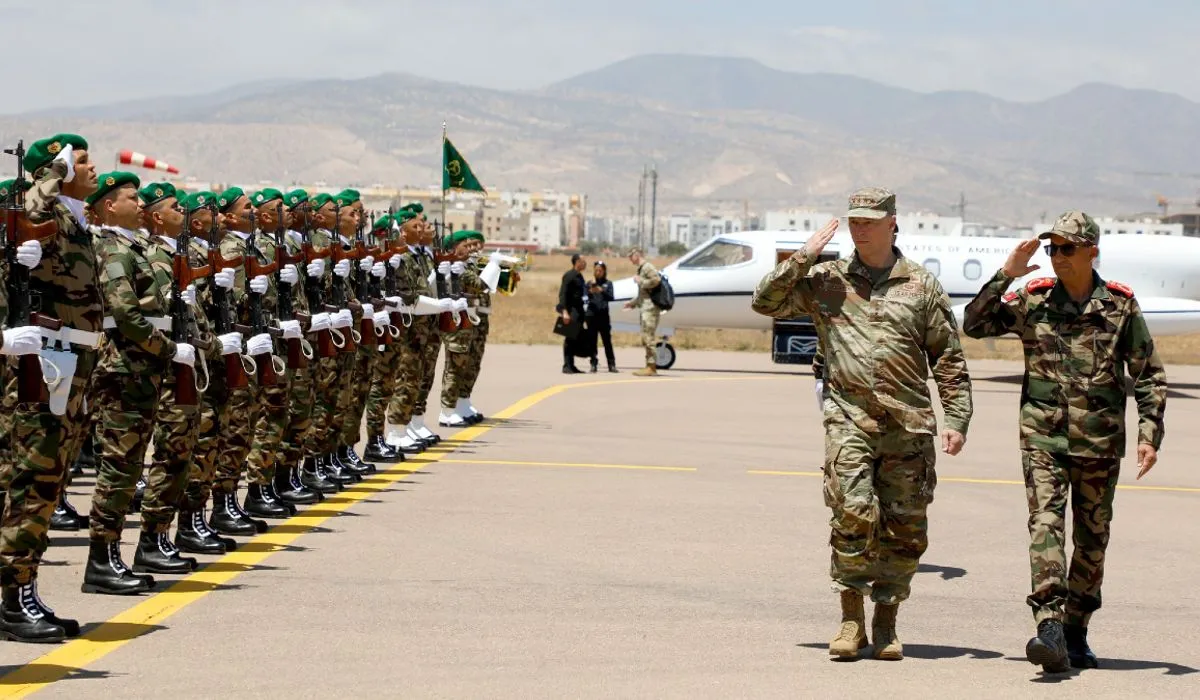
The most sensitive flank of this geopolitical mutation lies in the realm of national security and multidomain defense. The coast of Western Sahara represents one of the most utilized geographical platforms by criminal networks dedicated to human trafficking for launching vessels bound for the Canary archipelago, forming the so-called Atlantic route for irregular migration. Under the new prospective scenario, a Morocco endowed with full international sovereignty over the Sahara would legally become the exclusive gendarme of the entire northwestern African maritime façade. This concentration of regulatory powers endows Rabat with an asymmetrical capacity to control the stability of public order within the Canary Islands. As explained by Manuel Sesma Pérez in his monograph, this new power balance "would impose on Spain the necessity to redefine its cooperation strategies, maritime deployment, and coordination with Morocco regarding rescue, reception, and combating illegal human trafficking." The security of the islands would become structurally linked to the solidity of bilateral understanding frameworks with the neighboring country, transforming the management of migratory flows into a powerful political leverage tool in the hands of the Alawite court.
As reported by vozpopuli.com.