
Heightened Fire Risk Across Multiple Regions in Morocco
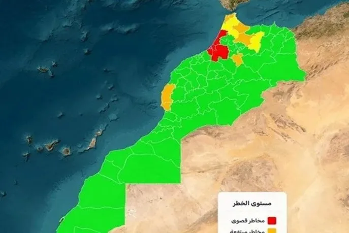
The National Agency for Water and Forests (ANEF) has recently released a detailed map indicating areas at risk of forest fires from May 26 to May 29. This assessment is based on scientific forecasting models that factor in climatic conditions, topographical features, and the flammability of forested areas. The map highlights several provinces throughout the Kingdom that are facing extreme, high, or medium levels of fire risk.
Regions Under High Surveillance
The data provided by ANEF indicates that the provinces of Kénitra, Khémisset, Rabat, Salé, and Skhirate-Témara are experiencing an extreme risk of fire during this period, characterized by conditions conducive to the outbreak of fires. Additionally, several other provinces, including Chefchaouen, Fahs-Anjra, Tanger-Assilah, Ifrane, Taounate, Essaouira, and Agadir-Ida-Ou-Tanane, have been classified with a high risk level due to a combination of climatic factors and environmental conditions that could accelerate fire spread.
Other regions, such as Larache, Ouezzane, Tétouan, M’Diq-Fnideq, and Taza, are currently categorized with a moderate risk level. ANEF stresses that even areas deemed to have moderate risk require vigilant monitoring due to the rapid changes that may occur in weather conditions.
In light of these alarming findings, ANEF urges residents, summer visitors, and professionals working within forested areas to exercise extreme caution. The agency advises against any actions that could potentially ignite a fire and encourages the immediate reporting of any suspicious smoke or activities near forest areas to the authorities.
As reported by quid.ma.