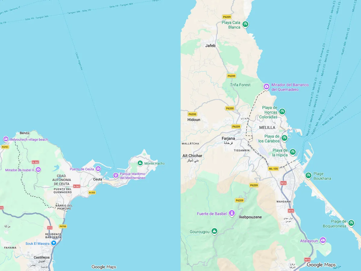

Google Maps and the Disputed Status of Ceuta and Melilla
For centuries, the cities of Ceuta and Melilla have been firmly established as part of Spain, with Ceuta being under Spanish sovereignty since 1580 and Melilla since 1497. However, since at least 2020, Google Maps has controversially classified these territories as "disputed," drawing a dashed line around their borders with Morocco instead of the solid line typically used for internationally recognized borders. This differentiation suggests a lack of consensus regarding territorial sovereignty, a position that has sparked significant political tension and debate.
This issue is not just a mere technicality; it reflects a broader geopolitical landscape where mapping services like Google Maps are influenced by international relations and pressures. For instance, Google has faced scrutiny for labeling Taiwan as a province of China until external pressures prompted a change. Similarly, the treatment of Ceuta and Melilla on Google Maps is not an isolated incident but rather part of a pattern where geopolitical considerations shape the presentation of borders.
The Impact of Recent Events on Territorial Recognition
The situation escalated dramatically after July 30, 2026, when approximately 60,000 migrants crossed into Ceuta, leading to a judicial examination of Spain's sovereignty over the cities. This surge of migration reignited discussions about the status of both locations, prompting the Observatorio de Ceuta y Melilla to formally challenge Google Maps for its portrayal of the region. The organization raised concerns that the mapping service's representation undermines Spain's claim to sovereignty.
Furthermore, the issue has repercussions for the Spanish government, which has faced criticism for utilizing similar mapping conventions that echo Google's representation. This has added to the complexity of the political landscape, especially in light of increasing international scrutiny over the status of these autonomous cities. Notably, while the Western Sahara is recognized as a non-autonomous territory by the United Nations, Ceuta and Melilla do not share this classification, complicating the narrative around their sovereignty.
As of now, Google has not publicly addressed the concerns raised by the Zeolandia association regarding the implications of their mapping choices. The classification of Ceuta and Melilla remains a point of contention, reflecting the intricate and often fraught relationship between geography, politics, and international recognition. Observers note that without a clear treaty or resolution backing the dashed line employed by Google Maps, the status of these territories continues to be a diplomatic minefield for Spain and its relations with Morocco.
As reported by xataka.com.