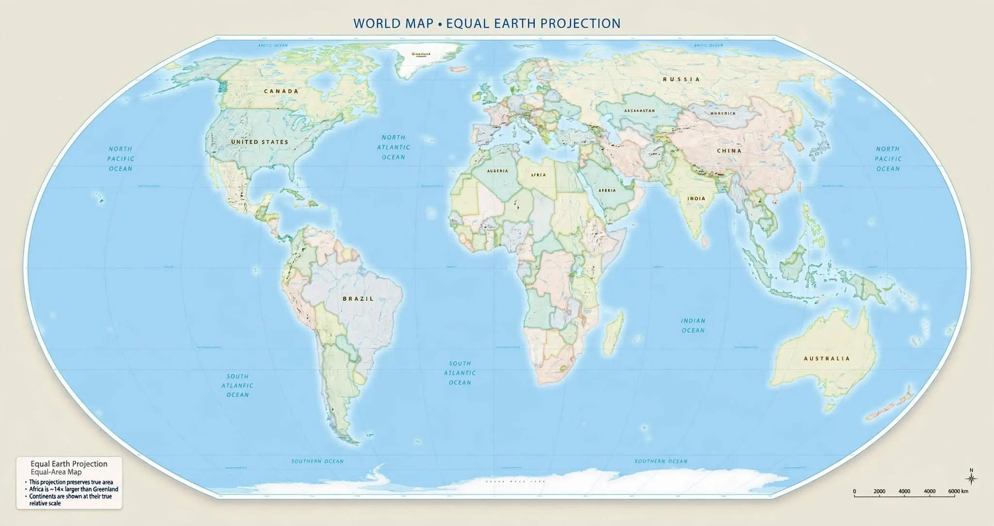

The Kingdom of Morocco has once again showcased its internal contradictions regarding the contentious issue of Western Sahara. This time, at the United Nations General Assembly, Morocco's representative made headlines by endorsing a new representation of the African map, which distinctly separates its territory from Western Sahara—a region it claims sovereignty over. On a notable evening, the UN General Assembly adopted a resolution branded as historic under the banner "Correct the Map," which aims to rectify decades of geographical marginalization that has affected the African continent due to the Mercator map projection. The resolution received overwhelming support, passing with 164 votes in favor, one against (the United States), and six abstentions. Morocco, without hesitation, supported a map that reflects its actual borders while excluding Western Sahara, a region still recognized by the United Nations as a non-autonomous territory, thus not under Moroccan sovereignty as the Moroccan establishment would have the world believe.
The Moroccan establishment, often referred to as the Makhzen, is now confronted with the stark reality of the situation. A resolution presented by the United States and voted on in October 2025 by the UN Security Council, which considered Morocco's autonomy plan as a potential solution, has not altered the status of Western Sahara, which remains classified as a territory separate from Morocco according to UN standards. Ahmed Attaf, the Algerian foreign minister, pointed out this discrepancy in response to the Security Council vote, emphasizing that the resolution made no mention of the Moroccan state or its sovereignty over Western Sahara. The Moroccan government, which celebrated the adoption of this resolution as a victory, must now face the reality that contradicts its propaganda and policy of fait accompli. At the African Union, where it sits alongside the Sahrawi Republic without any qualms, as well as at the UN General Assembly, Morocco's support for a map that does not acknowledge its sovereignty over Western Sahara is telling. Notably, the Moroccan press has been conspicuously silent on the representative's vote favoring the map that delineates Morocco apart from Western Sahara, seemingly embarrassed by the implications of this decision.
The resolution passed at the UN General Assembly, dubbed "Correct the Map," has successfully adjusted the map of Africa and Morocco to reflect its true dimensions, distancing it from the triumphant narratives that Morocco often presents following international recognition of its autonomy plan, which it equates to an acknowledgment of its sovereignty over Western Sahara.
In a statement, the Chairperson of the African Union Commission, Mahmoud Ali Youssouf, praised the UN General Assembly's resolution for fostering a more equitable and accurate cartographic representation of Africa and other regions globally. He commended the members of the African Union for their unity and collective action in support of this initiative. The AU expressed that the adoption of this resolution marks a significant advancement, encouraging international institutions, educational systems, publishers, and digital platforms to progressively adopt cartographic representations that more accurately reflect real territories. According to the statement, Africa must be depicted as it truly exists, in its genuine dimensions, and occupy its rightful place in the world.
As reported by lalgerieaujourdhui.dz.