
The Ambitious Digital Twin of Water in Morocco
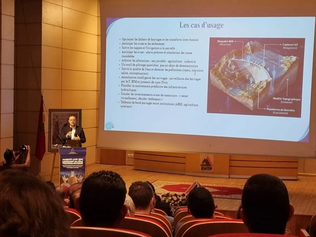
Located within the future scientific tower of the EHTP (Hassania School of Public Works), the Digital Twin of Water project aims to establish an updated virtual replica of Morocco's national water system. This innovative initiative will encompass everything from watersheds to aquifers, providing a comprehensive understanding of the country's hydrological landscape. As elaborated by Professor Hassan Jarar Oulidi, an expert in digital twins and a key figure in this groundbreaking project, the Digital Twin of Water represents the first of its kind in Morocco. It aspires to create a unique synergy between researchers, engineers, and industry players, transcending academic boundaries to foster collaborative efforts in water management.
This digital infrastructure will utilize real-time data from sensors, satellites, and artificial intelligence to centralize previously scattered information. This capability will allow stakeholders to simulate crisis scenarios such as floods and droughts in mere minutes, enhancing decision-making efficiency in critical situations. A pilot version of this digital twin is expected to be operational within 18 to 24 months, leading to a nationwide deployment that promises significant economic benefits that could far exceed the initial investment.
Transforming Water Resource Management
The Digital Twin of Water is designed to serve as a living virtual model of the national water system, which includes rivers, dams, and aquifers. This state-of-the-art digital tool aims to address pressing challenges like drought, resource scarcity, over-extraction of aquifers, and flooding, as well as improve overall dam management. Professor Oulidi emphasizes that this tool will enable real-time monitoring, risk anticipation, and scenario testing, akin to a flight simulator but focused on water management. Developed within the scientific tower, this project will leverage a robust data center, cloud services, cybersecurity measures, and simulation platforms.
Continuously fed by satellite data, ground sensors, and scientific models, the Digital Twin will provide a real-time reflection of the country's water resource status. It will serve as a unifying project within the scientific tower, promoting direct collaboration among researchers, engineers, and decision-makers. Moreover, the platform will enhance the reliability of decisions by allowing for the simultaneous evaluation of multiple water management scenarios, significantly reducing uncertainties.
Artificial intelligence will expedite data analysis and processing, improving forecasting and facilitating the detection of territorial changes. It will complement traditional hydraulic and hydrological models, creating a more integrated approach to water resource management. Importantly, this digital twin will not only be a tool for decision-makers but will also have applications in training, academic research, and industrial needs.
The initial pilot of the Digital Twin is set to be operational within the next couple of years, paving the way for a gradual national rollout. International experiences illustrate that such strategic projects yield substantial benefits related to water savings, infrastructure optimization, and risk reduction, often far exceeding implementation costs. The digital twin will be structured in a three-tiered pyramid architecture, with the foundational layer comprising various data sources, including weather, hydrological, and geological sensor networks, satellite observations, and data generated by hydraulic basin agencies.
The middle layer will focus on intelligence, ensuring data fusion, analysis, and value generation to produce a coherent, dynamic, and updated digital representation of the territory and water resources. This layer should rely on a national sovereign data platform housed in Morocco, integrating hydrological, hydraulic, and hydrogeological models alongside artificial intelligence algorithms. At the apex will be the decision support layer, providing interactive geospatial dashboards, 2D/3D geoportals, dynamic mapping atlases, and alert systems for real-time monitoring and proactive water resource management.
As reported by medias24.com.