
TVE's New Weather Map Sparks Controversy
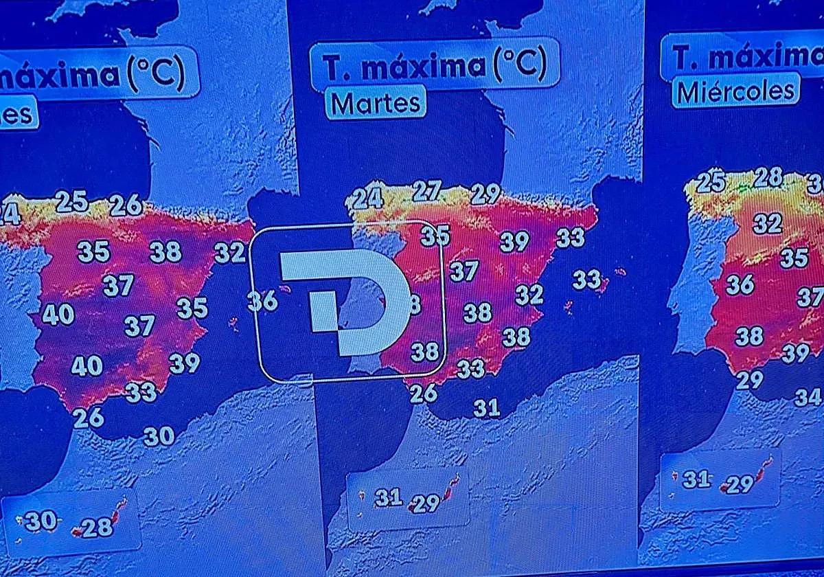
In a surprising move amidst ongoing political tensions related to the migration crisis involving Ceuta and Morocco, Televisión Española (TVE) has revamped its weather map, now depicting the Canary Islands as part of Moroccan territory. This change comes at a sensitive time and has raised eyebrows among viewers and political commentators alike. Traditionally, the weather map has included the Canary Islands in a box that typically places them in the Mediterranean, nestled between the Balearic Islands and North Africa. However, in this new presentation, the islands are unambiguously situated over Moroccan soil, a decision that appears ill-timed given the current political climate surrounding migration.
The rationale behind this reconfiguration likely stems from an attempt to enhance the presentation of weather reports, allowing meteorologists to reference the islands more conveniently while presenting full-body on-screen. Nevertheless, the implications of such a location shift, especially during a period marked by discussions about Morocco's responsibilities regarding migration, seem to lack consideration for both context and sensitivity.
TVE is not alone in its struggle to accurately represent the geographic location of the Canary Islands; other broadcasters, such as La Sexta, have similarly placed the islands in a geographical box aligned with Lisbon, further complicating their representation in media. Such inaccuracies in geographical representation not only mislead viewers but can also perpetuate misunderstandings about the islands' true location and geopolitical significance. This situation underscores the importance of accurate geographical depictions in media, especially when public sentiment and political discourse are heavily influenced by such representations.
As reported by canarias7.es.